
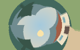
Understanding polar coordinates effect
Polar coordinate mapping wraps rectangular image coordinates into a circular arrangement.
Prepare matching left and right edges to reduce a visible join.
A practical workflow
- Choose the required source files, if any. Files are handled as stated in the workspace privacy label.
- Set the available controls and apply the operation.
- Compare the actual output, check its dimensions and download the generated file.
Decisions and limitations
- Strength (%)
- Radius or pattern size (pixels)
- Center from left (%)
- Center from top (%)
16 megapixels maximum. Artistic treatments are algorithmic approximations with adjustable settings. Exported PNGs are flattened. For two-image operations, the second image must match the first image dimensions.
Questions about this task
Where do I use the current tool?
Apply a deterministic image treatment to your uploaded pixels. These filters do not use an AI service.
What should I check for polar coordinates effect?
Prepare matching left and right edges to reduce a visible join.
Which settings and formats are confirmed?
PNG. 16 megapixels maximum. Artistic treatments are algorithmic approximations with adjustable settings. Exported PNGs are flattened. For two-image operations, the second image must match the first image dimensions.